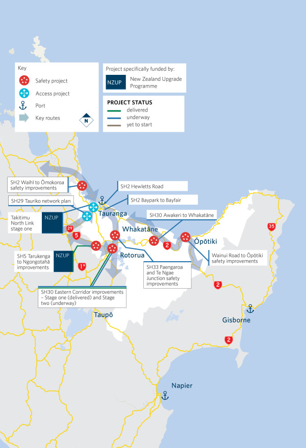
$1.5 billion has been forecast to be invested in the Bay of Plenty in the 2021-24 National Land Transport Plan (NLTP). This funding will support economic growth and respond to the needs of the growing population for better travel options.
Te Moana-a-Toi – Bay of Plenty NLTP 2023 update


Tupuna wāhine/female ancestors welcoming people to Tauranga Moana.
People of Tauranga and visitors to the city are now being welcomed by 3 striking pou whenua, representing 3 of the city’s tupuna wāhine/female ancestors. The new gateway to Tauranga was blessed by local hapū Ngāi Tukairangi, Ngāti Tapu and Ngā Pōtiki and unveiled by the rising sun on Friday, welcoming them into their final place, the new State Highway 29A roundabout.

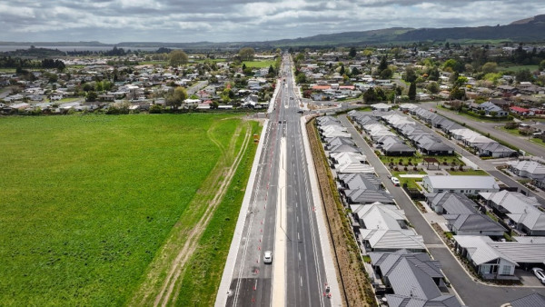
Eastern Corridor Stage Two is progressing well, with the second zone well underway.
The traffic lights at the intersection of SH30 Te Ngae Road and Basley Road are now in use and the eastbound detour via Vaughan Road has been removed.
There are still multiple worksites active between Iles and Ōwhata roads, and as work progresses layouts may change, so be aware and follow the temporary traffic management signs and markings.

Across the motu, Auckland, Northland, Waikato, Coromandel, Bay of Plenty, Tairāwhiti and Hawke’s Bay regions and Tararua district are facing a significant period of recovery and rebuild following extensive damage caused by Cyclone Gabrielle, the Auckland Anniversary floods and ex-Cyclone Hale. The immediate focus is on restoring access which is vital for communities.
North Island state highway recovery and rebuild
Work continued on the $262m SH2 Baypark to Bayfair Link, including construction of the Truman Lane walkway, walking and cycling connections, the ramp approaching SH2/SH29A Te Maunga interchange from Pāpāmoa, and SH2 road under the interchange.
Construction of the $150m SH2 Waihī to Ōmokoroa safety improvements continued, with six of the 10 sections completed. Work continues to install flexible median barriers and six roundabouts by 2026.
SH2 Waihī to Tauranga Corridor
Improving safety is at the heart of the Takitimu North Link project, which is a key strategic transport corridor for the region, providing greater travel choice with managed lanes, and a shared path for walking and cycling. NZUP has provided funding to build Stage One, the new 6.8km four-lane road connecting SH29 Takitimu Drive Toll Road through to SH2 west of Te Puna. Construction started in 2022 with work to build five of the eight bridges underway.
The Tauriko Network Connections enabling works detailed design was completed and consents lodged. Development of the construction programme has started, with work expected to begin in late 2023/early 2024. The Tauriko Network Connections Detailed Business Case for future transport improvements is expected to be approved in August 2023.
Work has started on an Indicative Business Case for accessibility improvements on SH2 Hewletts Road, a nationally strategic corridor.
Work continues to futureproof the key transport corridors in Rotorua. We are creating a safe and sustainable network that supports community wellbeing and makes people’s daily journeys more enjoyable.
Construction started on the first phase of the Crown Infrastructure Programme funded SH30 Eastern Corridor Stage Two. This $35m investment is addressing safety and connectivity with the Stage One improvements, while accommodating for future growth and providing better travel choices.
SH30 Eastern Corridor – Stage Two
The SH30 Te Ngae Junction to Paengaroa safety improvement project is in its final stage, with work underway on the last section – the southern side of the Sun Valley Curves. This project is expected to be finished later in 2023.
SH33 Te Ngae Junction to Paengaroa
Detailed design work on the SH2 Wainui Road to Ōpōtiki safety improvements continues, focusing on high-risk intersections.
Planned maintenance infographic for Bay of Plenty 2024/24 [PDF, 1.1 MB]
We’re committed to a collaborative approach to transport planning, funding and development. It’s an approach that delivers integrated transport solutions that best meet the needs of New Zealanders. To achieve these results, we seek open and honest consultation across a range of activities with all our stakeholders, including road users, business, local government, communities and iwi.
Find travel times, incident and roadworks information, and regional traffic updates on the Journey Planner.