Last updated: 19 May 2021
Frequently asked questions
- Are there cameras on the new CNC motorway?
There are 3 different cameras systems on the new CNC Motorway:
Operational CCTV System
The CCTV cameras along the CNC Motorway give almost 100% visual coverage of this new road. This information is used to help crews on the ground and in the Transport Operations Centres help manage traffic during congestion or traffic incidents. The cameras also play a role in the management of the T2 lane.
T2 Lane Cameras
These cameras are used to monitor the T2 lanes and are close enough to the ground to be able to see inside vehicles. These cameras will be used to monitor vehicles travelling in the T2 lanes.
Automatic Number Plate Recognition (ANPR) Cameras
These cameras 'read' the number plates of vehicles at different points along the CNC corridor. This information is used to calculate travel times along the road, and this is then displayed on the journey time signs. Number plates are encoded within the cameras so individual vehicles number plates cannot be retrieved.
Close
- What is the Christchurch Northern Corridor?
The Christchurch Northern Corridor is a combined contract to build these related projects as one:
- The Transport Agency’s Christchurch Northern Corridor Project – a new four-laning motorway from just south of the Waimakariri River, bypassing Belfast and Redwood to the east and connecting with QEII Drive near Winters Road.
- The CCC’s Christchurch Northern Corridor Extension project – a four lane link from QEII Drive to Cranford Street.
- The CCC’s Cranford Street Upgrade project – the four laning along Cranford Street to Innes Road and upgrading the Cranford/Innes intersection.
The CNC project also includes; an upgrade of QEII Drive to four lanes between Main North Road and Innes Road which will reduce congestion and delays for traffic travelling to the port, the addition of a third north and southbound lane on the Waimakariri Motorway Bridge and a clip-on cycle way, off-road pedestrian and cycle facilities linking to existing and new cycle facilities in the area and improved drainage infrastructure.
Close
- Why is this project needed?
Main North Road (State Highway 74) passes through Belfast and Redwood and provides the main access to the Christchurch City Centre and Lyttelton Port from the north (via QEII Drive). The large volume of local and through traffic travelling along Main North Road is creating and experiencing significant congestion - reducing safety and efficiency for people using this vital road. Even though substantial efforts are being made to reduce congestion by changing behaviours, congestion is still going to increase as residential and business development continues in the north and the wider city.
This project will unlock space for all travel modes and the transport solutions the community want to see like improved public transport, improve safety, reduce congestion, and more walking and cycling options.
An efficient and reliable transport network into, out of and across Greater Christchurch is important to the social, economic and environmental future of the City and the South Island. Efficient transport links to Lyttelton Port are also critical for supporting New Zealand trade.
Close
- How much will it cost to build and how is it funded?
The construction of the project is expected to cost $290 million. This amount has increased from the figure announced at the end of 2016 when the project began because we have added new work into the CNC project. This work includes the additional southbound lane on the Waimakariri Bridge, the Clip-on cycle path on the Waimakariri Bridge, the extension of the cycle path from Empire Road to Tram Road, the additional work for the High Occupancy Vehicle (HOV)/ Carpool lanes and the associated information technologies needed for this.
The majority (about 87%) of the project is being funded by the NZ Transport Agency with funding from the National Land Transport Fund (NLTF) which is collected from fuel excise duty (FED), road user charges (RUC) and vehicle and driver registration and licensing charges. The rest of the project is being funded by the Christchurch City Council (CCC). However, not all this funding is from council rates, around 50% of the funding for the CCC section of the CNC project also comes from the National Land Transport Fund (NLTF).
The additional work on Cranford Street south of Innes Road and on surrounding streets is not part of the CNC Alliance project. This work is being managed and funded by the CCC. As with the majority of CCC roading projects, around 50% of this funding is also coming from the National Land Transport Fund (NLTF).
Close
- How long is the Christchurch Northern Corridor?
The Christchurch Northern Corridor project is about 12km long from the Waimakariri River to the Cranford/Innes Intersection plus another 4km for the QEII Drive four-laning.
Close
- When will it be finished /open?
The Christchurch Northern Corridor opened to traffic on 17 December 2020. But, there is still work to do to finish off the project.
Now much of this project is chip seal, but this is not the final surface. In spring 2021 we will apply a final low noise asphalt layer. It is industry best practice to leave the road to weather for a time before this final surface is applied.
Close
Landscaping work along the shared path and motorway alignment is ongoing, including weed control and planting more trees and plants in the upcoming autumn season, April to September 2021.
- Will the Christchurch Northern Corridor reduce traffic on Main North Road and Marshland Road?
Yes. With commuters from North Canterbury and North Christchurch and freight traffic using the Christchurch Northern Corridor, traffic volumes on Main North Road and Marshland Road will drop significantly. This will reduce congestion, improve travel times for all road users and improve amenity for local residents. It will also assist in making these roads safer for all users including cyclists and pedestrians, and free up room for public transport facilities.
Our traffic modelling shows that traffic volumes on Main North Road (Redwood) in 2015 were 35,000, by 2026 the number of vehicles on Main North Road (Redwood) per day will be 42,000 if the Christchurch Northern Corridor is not built and 24,000 if it is built.
There were 15,000 vehicles a day on Marshland Road in 2015. By 2026 there would be 29,000 vehicles a day if the Christchurch Northern Corridor is not built or 18,000 if the Christchurch Northern Corridor is built.
By 2026 42,000 vehicles a day will use the Waimakariri to QEII section of the Christchurch Northern Corridor.
(This modelling is based on post-earthquake traffic flows and updated development and growth predictions, and assumes the Western Belfast Bypass, another NZ Transport Agency project, is built. By 2026 the Western Belfast Bypass will carry 24,000 vehicles a day.)
Close
- How will the Christchurch Northern Corridor affect public transport?
Once the Christchurch Northern Corridor project is completed, control of Main North Road will be handed to Christchurch City Council (CCC). As the construction of the Christchurch Northern Corridor will result in significantly reduced traffic volumes on Main North Road, there is an opportunity for CCC to make changes to Main North Road which will further enhance public transport along the route, extending bus lanes, and making changes to intersection configurations or even considering other public transport options. Some of this work has already happened. These changes will result in improved public transport journey times along Main North Road which is likely to make public transport more attractive.
Metro is starting a new direct bus service to central Christchurch include four morning trips from both Rangiora and Kaiapoi, and five afternoon trips back to each township. More information on this and other ways to travel in the new Christchurch Northern Corridor can be on the Let’s Ride webpage.
Close
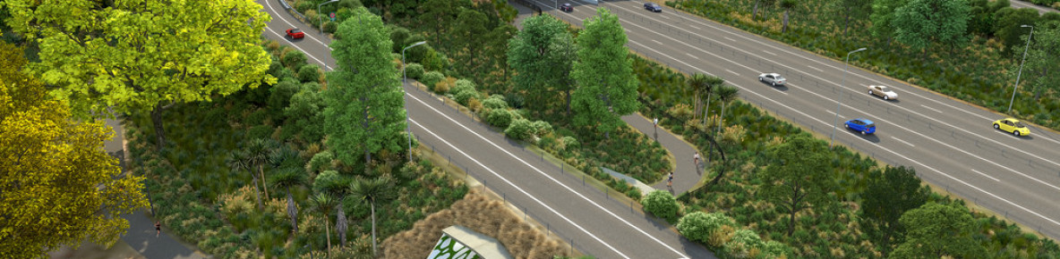
- Will there be provisions for pedestrians and cyclists?
A shared use off-road path is being constructed parallel to the Christchurch Northern Corridor from Tram Road to McFaddens Road. The CNC Shared Use Path starts at the Tram Road/Main North Road intersection and runs parallel to the northern motorway. A clip-on path on the Waimakariri Motorway Bridge will take pedestrians and cyclists over the Waimakariri River. The CNC Shared Use Path (SUP) then connects with Main North Road, Guthries Road, Belfast Road, Radcliffe Road, Prestons Road, QEII Drive, Grimseys Road, Winters Road, as well as Owen Mitchell Park and the future ‘Source to Sea’ pedestrian and cycle path along the Styx River. The off-road shared cycle path runs through the Cranford Basin and then along Cranford Street to end at McFaddens Road. From McFaddens Road, an on-road cycle lane will be included on both sides of Cranford Street to Innes Road. A link is also being built to connect the CNC SUP to the Papanui Parallel cycle path.
The shared use path will provide and link to safe travel options between North Canterbury and St Albans. Cycle facilities on QEII Drive will be improved as part of the QEII Drive four-laning and will connect to the CNC shared use path at Grimseys Road and Winters Road.The Christchurch Northern Corridor will also significantly reduce traffic on Main North Road and Marshland Road making these roads safer and more appealing for cyclists and pedestrians.
Close
- Will the Christchurch Northern Corridor be elevated?
Most of the Christchurch Northern Corridor will be constructed at or near ground level. Overbridges will be constructed so local roads can go over the Christchurch Northern Corridor (Belfast Road, Radcliffe Road and Prestons Road). These overpasses will be about eight metres high.
The Christchurch Northern Corridor will be elevated by about eight metres above surrounding ground level at the northern end of the alignment, to pass over the Main North Railway line and Main North Road. It will also be elevated at the southern end for the QEII Drive interchange.
Close
- How will noise be managed?
Low-noise asphalt will be used along most of the new motorway. This is a quieter surface than the chipseal used on many roads. Noise reducing earth bunds, fences or concrete barriers will also be used where possible in areas near housing.
It is believed that these mitigations will keep noise to an acceptable level. Testing and modelling were used to measure and predict noise levels in the area before any changes were made, and these findings have been used to design the noise mitigation for each area of the project. The NZ Standard for Road traffic noise – new and altered roads (NZS 6806:2010) is being used.
All the noise mitigations required for this project are in place except for the final asphalt layer on the road. The asphalt surface, that is significantly quieter than a chip seal surface, cannot be laid until the next sealing season (spring) after the road has had a chance to weather, this is in line with industry best practice. This is in line with industry best practice.
In response to concerns around traffic noise, we have done some additional early monitoring, before the final low-noise asphalt is laid. We measured the sound levels in seven locations along the project with results between 54-61 deciBels (dB). These early results show the mitigations already in place and required by the resource consent, ie the bund, fences and concrete barriers are working as expected, and once the low noise asphalt is applied, we expect this level will drop another 5 to 7dB. We are confident that the final low noise asphalt will be effective at bringing the noise levels under that required by the NZ Standard for road noise near residential properties (NZS 6806:2010) which for a new road is 57 dB (averaged over 24 hours) or less. This represents a significant decrease in noise which should be very noticeable for residents.
Will the noise level increase as traffic numbers increase?
Noise increases with vehicle numbers, that’s why the mitigations for the motorway were designed with a higher number of vehicles in mind (we are expecting about 35,000 vehicles in a decade or so). We are confident that the CNC motorway will still meet the noise levels predicted by the modelling with increased traffic on it, when all the noise mitigation measures are in place (including the asphalt layer).
Could you plant more trees or dense vegetation to reduce the noise?
Trees and shrubs indeed provide a psychological impression of less noise but are not the most effective barriers. Dense vegetation makes little difference. Sound experts will recommend impermeable barriers of concrete or wood, they deflect noise much better than for instance hedges. The CNC urban design landscape plan is actually not part of the noise mitigation measures, it may over years contribute a little, but the earth bund with timber fences, the concrete barriers and the special asphalt will make the noticeable difference.
Can you reduce the speed limit on the motorway to 80km/h to reduce the noise?
Decreasing the speed limit will reduce noise. However, in order to be effective a substantial reduction is necessary. Reducing the speed limit to 80km/h would only reduce the noise leave by 1 to 2dB and this is not noticeable to most people. The Christchurch Northern Corridor is designed, constructed and maintained at 100km/h and the speed limit for heavy vehicles and vehicles towing remains at 90km/h. There would be little to no benefit in reducing this speed limit. The motorway with a speed of 100km/h provides for several benefits: reducing congestion, reducing travel times and improving productivity (net economic benefit).
What about the gap in the fencing at Owen Mitchell Park?
Noise mitigation measures work best when: they are close to the source of the noise - like the concrete barriers or close to housing like to the earth bund and fencing. There is a gap in the bund and fencing at Owen Mitchell Park to allow for safe access to and from the park and the shared path on the CNC. As there is no housing near this gap in the bund and fencing, it is not creating an area where housing will have a noise level over the traffic noise standard.
Close
- How do we measure noise?
Noise levels are expressed in units of decibels (dB), which are a measure of the air pressure change caused by sound. Measured noise levels include all frequencies, but as our hearing is less sensitive to lower frequencies, the measured levels are adjusted to correspond to human hearing. This adjustment is called “A weighting” and is identified by the letter “A”.
Traffic noise levels fluctuate so they are reported as an average value over a period of time. In New Zealand the period of time for which the average is calculated is 24 hours.
Because decibels are a logarithmic unit, they cannot be averaged like normal numbers, instead the average is determined from the ‘energy levels’ and reported as an ‘equivalent’ noise level on an energy basis. You can think of this averaging as one where louder noises have a disproportionate effect on the average. For example, the average of 40 dB and 60 dB both measured over the same time period is approximately 57 dB (not 50 dB, as with simple averaging).
In our information you may see sound levels reported in units of “dBLAeq (24h)“ – this is an abbreviation of the 24-hour continuous sound level equivalent in “A-weighted” decibels (colloquially referred to as the 24-hour average).
Close
- What is the New Zealand Standard 6808:2010 and how was it developed?
NZS 68062010 Acoustics – Road traffic noise – New and altered roads sets out procedures and requirements for the prediction, measurement, and assessment of road traffic noise for new and substantially altered state highways and local roads. It also provides best practice guidance and advice on methods for mitigating reverse sensitivity situations and the environmental effects of noise exposure on nearby noise-sensitive activities.
The Standard was developed taking into account health issues associated with noise; the effects of noise levels on people and communities; affordability considerations and the potential benefits of roads to people and communities. The Standard recognises, as does the World Health Organisation, “that the evaluation of control options must take account of technical, financial, social, health and environmental factors."
The committee that developed the Standard, was made up of representatives from a wide range of organisations that include Local Government New Zealand, Ministry of Health, Ministry of Transport, New Zealand Transport Agency, Road Controlling Authorities NZ, Department of Building and Housing, NZ Acoustical Society, NZ Institute of Environmental Health, Roading NZ, and Ingenium.
NZS 6808:2010 Acoustics – Road traffic noise
Close
- Why aren't the noise level criteria lower at night when most people are sleeping?
The level of noise from a road varies over a day depending on things like traffic volume and speed, the mix of individual vehicles on the road (eg, passenger cars and heavy vehicles), as well as the weather conditions and temperature.
Average noise levels will most likely be highest during commute hours and during the day, when traffic volumes are also highest. Average noise levels from the motorway will reduce over the night and gradually increase again from early morning to the peak morning commute period.
Noise from individual vehicles does not change throughout the day so everything else being equal, the noise from an individual heavy vehicle or car passing at night or in the day remains the same.
Outside noise is typically lower at night and as most people also sleep this is when noise is often most disturbing. Some countries have separate criteria for road-traffic noise to address increased sensitivity to noise at night. In New Zealand, the previous “Transit Guidelines” and the current New Zealand Standard use a noise level averaged over a 24-hour period.
The criteria is based on people’s response to ‘real life’ traffic noise over a 24-hour period, including exposure to noise at night and exposure to individually noisy vehicles. The studies supporting the response to noise are population-based rather than individually-based, and consider annoyance, disturbance and health impacts associated with exposure to road-traffic noise over years.
So while the New Zealand Standard only provides criteria for noise averaged over 24 hours, those criteria were developed based on people’s response to real-life traffic, including noise at night. The noise metrics tool demonstrates how various noise metrics are incorporated in to the 24-hour average.
During development of the New Zealand Standard, separate day-night criteria were considered. The committee that developed the standard undertook a review of a number of existing roads in New Zealand, and looked at scenarios where 24-hour criteria were applied versus separate day/night criteria. This review concluded that similar noise mitigation requirements were likely regardless of the choice of whether day/night or a 24-hour average criteria were applied.
On the basis of this assessment, and the understanding that the 24-hour criteria included people’s response to noise during the night, the committee adopted a 24-hour averaging period for the noise criteria in order to simplify application of the criteria.
Noise metrics tool
Close
Fundamentals of sound
- What will be the speed limit on the Christchurch Northern Corridor?
The speed limit on the Christchurch Northern Corridor will be 100km/h between the Waimakariri River and QEII Drive. It will reduce to 80km/h at the interchange with QEII Drive. The speed limit on QEII Drive will remain at 80km/h and landscaping and urban design elements such as median and shoulder widths will be varied to slow traffic where the speed limit reduces to 80km/h. The speed through the Cranford basin section will reduce from 80km/h to 50km/h. The speed limit will not change on the Cranford Street section of the project, which is now 50Km/h.
Close
- Why is Marshland Road not being upgraded instead?
Upgrading Marshland Road was investigated and dismissed. This was in part due to unfavourable ground conditions meaning that widening and upgrading the road would require significant ground improvement and future maintenance costs, and also to the large number of existing property accesses on to Marshland Road. These roads and driveways limit the potential to develop a high volume, high speed arterial road. Plans for significant future developments adjoining this route would also require access to Marshland Road further reducing its functionality.
Close
- How will Cranford Street cope with traffic south-east of Innes Road?
The Christchurch City Council has plans to ensure traffic can continue along Cranford Street on the city-side of the Innes Road intersection. This plan includes: changes to Cranford Street to allow for clearways or a bus lane, upgrading some intersections and discouraging the use of residential streets as short cuts. Work on these improvements will start in 2020.
More information on this consultation can be found on the Christchurch City Council website:
Close
https://www.ccc.govt.nz/the-council/consultations-and-submissions/haveyoursay/show/142(external link)
- Why is there a barrier planned along Cranford Street up to Innes Road stopping right turns?
The barrier along Cranford Street has several functions; it will prevent front on collisions, reduce turning movement at intersections (thereby reducing hold-ups) and stop commuters using suburban streets as rat-runs or shortcuts. While this may mean the people who live in these areas have to drive a little farther to get home, the barriers will improve safety and quality of life for people living in these side streets by greatly reducing traffic.
Close
- When will the Cranford Basin storm-water improvements be done?
The upgrade of the Cranford Basin into an improved storm-water retention area and new forested wetland area is a separate project. Work on the improved storm-water retention area is now finished. Turning this area into a forested wetland area with public walkways and other facilities is a future Christchurch City Council project that will need public support to gain funding through the council’s planning processes.
Close
- What consultation was done for this project?
See the consultation section on the Project background tab(external link).
Close
- What changes are planned for the Waimakariri Bridge?
The Waimakariri Bridge is being widened to provide for a third northbound lane and a third southbound lane. The third southbound lane which is planned to operate as a High Occupancy Vehicle (HOV) lane or carpool lane during morning peak. The widening is being constructed on the inside of the existing bridges. A new clip-on cycleway is being constructed on the outside of the southbound bridge. This work will be completed at the end of 2019.
Close
- Why does the project include operating a High Occupancy Vehicle (HOV) or carpool lane on the CNC?
The NZ Transport Agency recognises that a robust, long-term transport solution must include incentives for changing driver behaviour to increase vehicle occupancy and to make better use of infrastructure.
The lanes encourage a more efficient use of infrastructure by moving more people in fewer vehicles.
One of the ways to reduce congestion is to change transport user behaviour. If more people share vehicles, take buses or ride bikes the less cars will be on road.
Close
- Were you always going to include a carpool lane, was it in the original plans?
While the carpool lane was not part of the CNC project at the start of construction in late 2016, a corridor study in the same year put forward the idea of a carpool lane to manage ongoing traffic growth. The Canterbury Regional Transport Committee supported this idea in September 2017 as a variation to the Regional Land Transport Plan.
The CNC Alliance, supported by the Greater Christchurch Partnership, agreed to include a third southbound lane and a clip-on cycleway as part of the project in 2017. The CNC already had staff and equipment on site for the northbound widening so including the southbound widening made sense. Doing the work as part of the CNC project will be more cost effective, minimising impacts on the river and minimising disruption to users.
In 2018 the NZ Transport Agency conducted an investigation into the safe operations of a southbound carpool lane and this led to funding for design and construction.
Close
- Will cycle improvements be included across the Waimakariri River?
Yes, the widening of the Waimakariri Motorway Bridge includes a 2.5m clip-on shared use path (SUP) to get cyclist and pedestrian safely over the Waimakariri River. A SUP also run the entire length of the CNC.
Close
- Will this project increase traffic on Cranford Street and QEII Drive?
The CNC motorway may attract some traffic that may otherwise have used Marshland Road or Papanui Road but the majority of traffic entering Cranford Street or QEII Drive from the new Christchurch Northern Corridor would have travelled this way anyway; but they would have travelled via Main North Road.
Traffic growth due to businesses and residential growth in Christchurch and Canterbury will cause traffic to increase on all main roads including both Cranford Street and QEII Drive over the next decade regardless of this project. However, because of the changes on Cranford Street and QEII Drive these roads will be able to cope with this extra traffic. When the CNC opens in 2020 we expect the traffic volumes on Cranford Street to be about 34,000 vehicles per day.
The Christchurch City Council has further improvements planned for Cranford Street from Innes Road to the CBD and other local roads in this area. These plans include, changes to Cranford Street to allow for clearways or a bus lane, upgrading some intersections and discouraging the use of residential streets as short cuts. This work should get underway in early 2020.
Close
- How is the CNC Alliance managing environmental effects?
As well as adhering to all environmental legislation and our consent conditions, the CNC Alliance is also seeking a Greenroads certification to demonstrate our commitment to environmental outcomes. This means we are going above and beyond minimum environmental, social and economic practices.
Find out more about this on the NZTA Greenroads site:
Close
https://www.nzta.govt.nz/about-us/about-the-nz-transport-agency/environmental-and-social-responsibility/state-highway-approach-to-environmental-and-social-responsibility/greenroads/
- What will the landscaping and urban design be like?
This motorway corridor will become the main northern entrance to Ōtautahi Christchurch and we want this arrival experience to celebrate Christchurch’s proud natural character and love of parks and gardens.
The urban design concept for this project has been christened in house the ‘Totara Highway’ as we hope to reflect the historic ecology of the area while also acknowledging the changes that have happened as local communities have grown. This concept will create a parkland corridor, which softens the edges of the new motorway, providing pleasant human-scale places. The shared pedestrian/cycle path will meander through a natural landscape connecting locals to schools, shops and work. The plants we are using are almost entirely native with seeds sourced locally. Many of our urban design features will also have a native plant motif including the three bridges you will drive under as you enter Christchurch. These will also have light features to add interest and enchantment at night.
We hope the urban design and landscaping design is sensitive to the current and historic environment. We want the motorway corridor to enhance the everyday lives of the local community for generations to come.
More info on our landscaping/urban design is in our urban design draft concept plan: https://www.nzta.govt.nz/assets/projects/christchurch-northern-corridor/Urban-Design-Draft-Concept-Nov-2016.pdf [PDF, 6.8 MB]
Close
- How much travel time will be saved once the new motorway is open?
Since the Western Belfast Bypass has opened congestion from the north has improved. However, travel times to and from North Canterbury still vary, especially in the morning and evening peaks. This inconsistency makes travel frustrating and difficult to plan reliably. Once the new motorway is open travel time is expected to improve via both Main North road and Marshland Road. Travel times between Woodend and Bealey Avenue are expected to average out as follows once the CNC is open:
- Morning peak if travelling via Main North Road - 30 minutes
- Morning peak if travelling via CNC Motorway - 25 minutes
- Evening peak if travelling via Main North Road - 28 minutes
- Evening peak if travelling via CNC Motorway - 23 minutes
- Will there be enough room for two tracks under the new rail bridge on the CNC?
Yes. The rail bridge near Main North Road allows room for double tracking if needed in the future.
More info on commuter rail to and from Christchurch and North Canterbury is available on the Northern Corridor congestion – facts, stats and answers page
Close
https://www.nzta.govt.nz/projects/christchurch-motorways/northern-corridor-congestion/
- How will the Christchurch Northern Corridor connect with existing roads at the northern end?
In order to connect the Christchurch Northern Corridor to the existing Northern Motorway some changes are required:
- The existing Chaneys on-ramp will be removed, meaning there will be no access at this point onto the Northern Motorway. Access will be provided further west by using Main North Road.
- Traffic heading south on the Northern Motorway will veer left onto the Christchurch Northern Corridor (CNC).
- Traffic heading north on the Christchurch Northern Corridor will go under the Northern Motorway’s southbound lanes, where the Northern Motorway with merge with the CNC northbound north bound lanes. (An additional northbound lane is required on the existing Waimakariri River Bridge to provide for safe and efficient traffic merging from the Western Belfast Bypass, Main North Road and the Christchurch Northern Corridor. The three lanes northbound will be extended through to Tram Road.
- How will the Christchurch Northern Corridor connect with existing roads at the southern end?
The Christchurch Northern Corridor will connect at QEII Drive with a 'grade-separated' interchange. The Christchurch Northern Corridor will go over the top of QEII Drive on a bridge. Under the overbridge there will be on and off-ramps and two connected roundabouts that will make access in all directions possible. (This interchange will be like the Southern Motorway /Curletts Road interchange.)
The north/south priority (Christchurch Northern Corridor over QEII Drive) was chosen as it is a less complicated layout for users and provides the best traffic performance for through traffic into the City. It does not require as much land, it uses the existing alignment of QEII Drive and it keeps the Christchurch Northern Corridor further away from adjacent housing than other options that were considered.
The Christchurch Northern Corridor will then go through Cranford Basin and connect into Cranford Street via a new roundabout.
This video shows how to use the QEII interchange.
How to use the QEII interchange. Close
- Where is access to the Christchurch Northern Corridor provided?
Belfast Road (via south facing ramps)
South facing on and off-ramps at Belfast Road will allow northbound traffic to exit at Belfast Road and access for traffic wishing to head south from Belfast Road towards the city and Lyttelton Port. The southbound ramps at Belfast were pencilled in during consultation. As soon as the rezoning of the Belfast commercial area was finalised it was agreed that the southbound ramps at Belfast Road should be included in the CNC construction project.
QEII Drive
-
- The Christchurch Northern Corridor will go over QEII Drive on a bridge and full access will be possible to QEII Drive via on and off-ramps and roundabouts below the bridge (similar to the Southern Motorway/Curletts Road interchanges).
- Access will be provided from Winters Road west to the QEII Drive west roundabout.
SH1
-
- Just south of the Waimakariri Bridge southbound Northern Motorway driver will have the choice of veering left onto the Christchurch Northern Corridor or continuing on SH1 via the Western Belfast Bypass or exiting onto Main North Road.
Cranford Street
- Drivers will use a roundabout on Cranford Street to enter or exit the Christchurch Northern Corridor.
-
- How does this project fit into the planning for Christchurch? - UDS info and Belfast info
See the consultation section on the Project Background tab that has information on The Greater Christchurch Urban Development Strategy and the Belfast Area Plan
Close
https://www.nzta.govt.nz/projects/christchurch-motorways/christchurch-northern-corridor/project-background/
- What is an alliance and who is in it?
Traditionally, you would have a design ready for construction and the government would hire a contractor to build.
A project alliance is a single contract taking the project from concept design to completion. Project alliancing is an approach aimed at creating mutually beneficial relationships between all parties to ensure best project outcomes. Unlike traditional forms of contract where risk is allocated to different parties, under a ‘pure’ project alliance, the alliance participants take collective ownership and equitable sharing of all risks associated with the delivery of the project.
The risk/reward arrangements are designed so exceptional performance will deliver excellent outcomes for all parties while poor performance will result in poor outcomes for all parties.
Some of the alliance principles are:
-
- Collective responsibility for performance with an equitable sharing of risk and reward.
- A peer relationship where all participants have an equal say.
- All decisions must be best for the project.
- Clear responsibilities within a no-blame culture.
- Full access to the resources, skills and expertise of all parties.
- Innovative thinking with a commitment to achieve outstanding outcomes.
- Open and honest communication - no hidden agendas.
This alliance contract is between the NZ Transport Agency, Christchurch City Council, Fulton Hogan, Aurecon and Jacobs. It is a great example of central and local government working together to create a safe, reliable transport network that meets the needs of all road users, including cyclists, pedestrians and those using public transport.
Close -