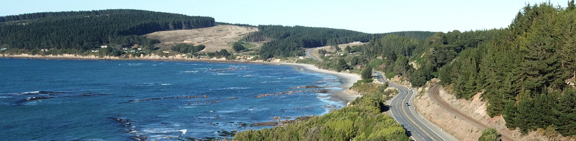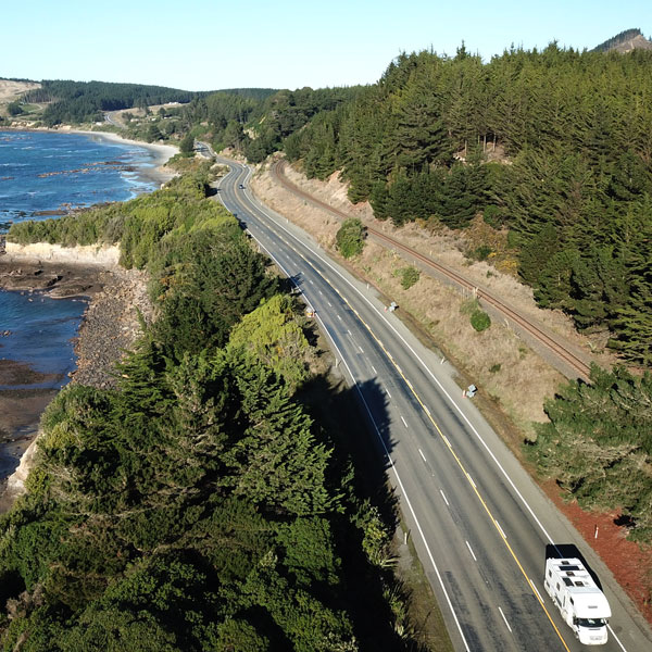
This project will use a variety of safety measures including safety barriers and improved road markings and signage to reduce crashes on a 23km section of SH1 from Palmerston to Hampden.
Road safety is a high priority for the government and a major focus for Waka Kotahi NZ Transport Agency. Everyone should be able to get to where they’re going safely - whether they’re driving, walking, cycling, or riding a motor bike.
This project is part of our investment in safer infrastructure to support New Zealand’s Road to Zero strategy, that sets us on a path to achieve Vision Zero, an Aotearoa New Zealand where no one is killed or seriously injured on our roads. Steady progress towards this target would mean approximately 750 fewer people are killed and 5,600 less seriously injured on our roads over the next 10 years.
Road to Zero – NZ’s road safety strategy
Waka Kotahi has been looking at more ways to increase safety on SH1 between Ōamaru and Dunedin. Communities along the route are growing, and there are several popular tourist attractions in the area, including the iconic Moeraki Boulders. From 2015 to 2019, there were five fatal crashes and six serious injury crashes on SH1 between Hampden to Palmerston.
Some safety improvements were previously carried out through the Safe Roads Programme for this section of highway. In 2017, Waka Kotahi installed electronic rural intersection warning and variable speed signs at the SH1/Moeraki intersection. The right-hand turn bay into the Moeraki Boulders site was also improved.
To help prevent driver distraction, an agreement was reached with the Waitaki District Council and Moeraki businesses to remove advertising signage along the highway in this area. These were replaced with an information board just off SH1 on the road to the Moeraki Village.
Communities in this area and Waka Kotahi transport partners understand this is a high crash risk highway and support safety improvements to reduce crashes.
Key features include:
| Detailed design | November 2021–July 2022 |
| Construction | To be confirmed |
Please note that the above time frames are indicative and subject to change.
This section of SH1 has been identified as high risk, with five fatal crashes and six serious injury crashes occurring over a five-year period. These improvements will help address dangers, save lives and substantially enhance safety for all highway users.
CloseSafety improvements are anticipated to begin in January 2022 and will take two years to complete.
CloseThis section does not require land purchase, restricted access or large intersection improvements and can be delivered quickly to realise the safety benefits without delay. We will also be delivering safety improvements from Herbert to Hampton in late 2021.
CloseThere is no speed review or speed changes currently planned for this section of SH1.
Close