
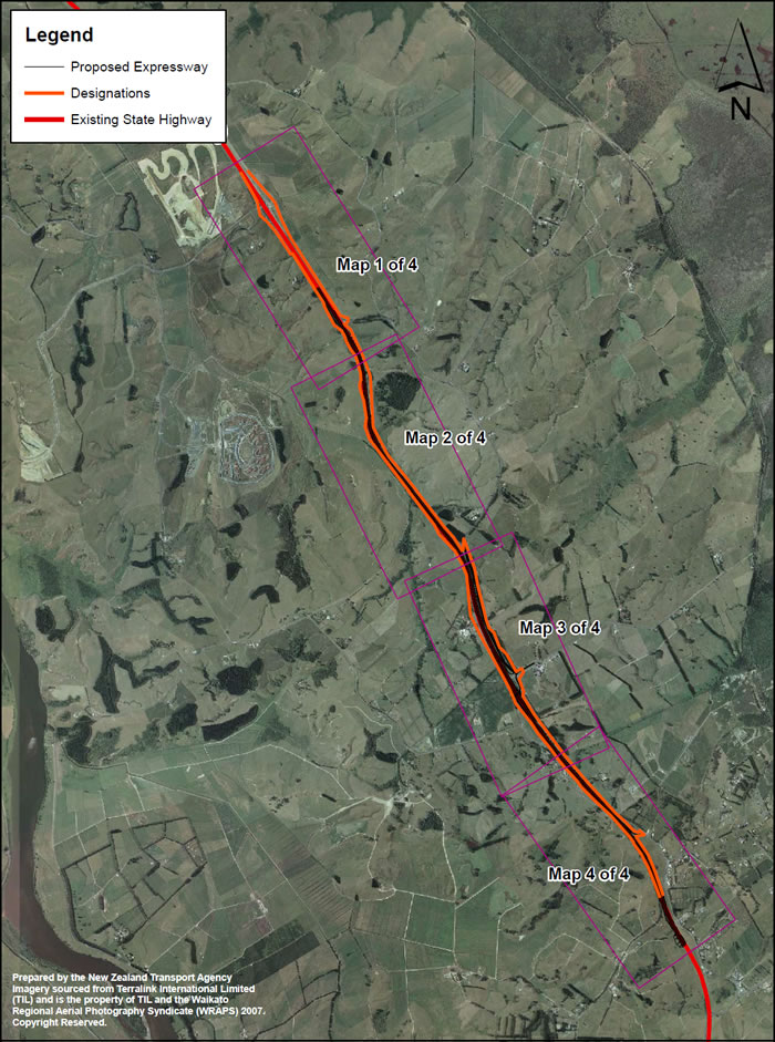
The Longswamp section of the Waikato Expressway links the already completed Mercer section (just south of the Hampton Downs Interchange) to the Rangiriri section to the south. This project involves the upgrading of 5.9km of SH1 to full expressway standard.
When complete the Waikato Expressway will be the key strategic transport corridor for the Waikato region, connecting Auckland to the agricultural and business centres of Waikato and Bay of Plenty. The expressway will improve economic growth and productivity through more efficient movement of people and freight.
reducing travel times between Auckland and Cambridge by 35 minutes
reducing significantly the number of fatal and serious injury crashes
reducing fuel costs
reducing traffic congestion within smaller communities like Huntly, Ngaruawahia and Cambridge
increasing the highway's capacity and passing opportunities.
The Waikato Expressway will be 102km long, running from the Bombay Hills to south of Cambridge. It will provide for two lanes of traffic in each direction divided by a central median barrier. Local roads and interchanges will generally be serviced by bridges and underpasses.
The Longswamp section will:
