Location: Champion Road / Salisbury Road, Richmond
Project type: Roundabout with dual cycle/zebra crossings on raised platforms
Project elements: CNG: Dual cycle / zebra crossings, CNG: Roundabouts, PNG: Raised zebra crossings
Project Owner: Tasman District Council
Project completion: May 2021
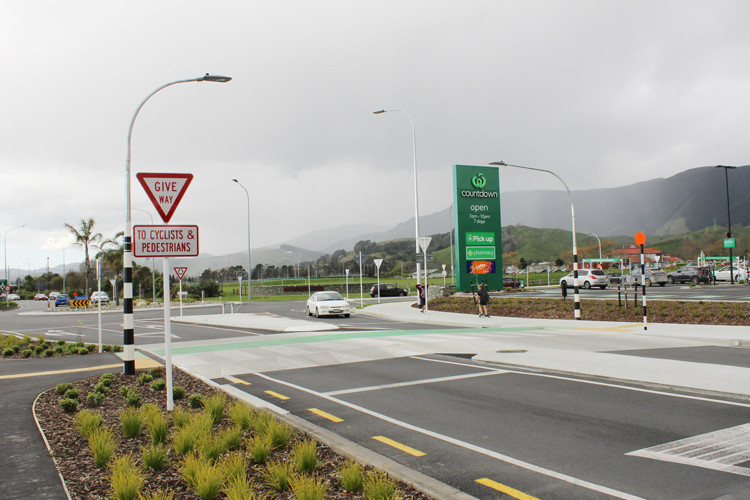
To illustrate how a retail development next to an existing roundabout was the catalyst for road safety improvements, particularly for pedestrians and cyclists. Additionally, quality connections were made to existing walking and cycling routes, schools, and the retail development. This was achieved by retrofitting and reconfiguring an existing roundabout intersection.
Further details can be found in the Road to Zero video: Championing the Safe System in Tasman(external link)
|
Benefit |
Target user group |
Method |
|
Safety |
All users |
Changing the operational focus of the roads to being safety outcome orientated especially for vulnerable road users. |
|
Operation |
Local community and school children |
Changing the operational focus of the roads from being motor vehicle focused to a multi-modal. Through the provision of traffic calming, at grade crossings and a speed managed road. |
|
Speed management |
All users |
Managing speeds through the provision of traffic calming, at grade crossings, tight geometric roundabout layouts and providing single not multi-lane roadways |
|
Travel choice |
School children, shoppers, pedestrians, and cyclists |
Providing quality facilities to encourage walking and cycling within the local area, to the retail and leisure facilities near the roundabout to provide connections to longer distance cycling / walking networks. |
|
Network completion |
Pedestrians and cyclists |
Connecting missing links in the existing pedestrian and cycle networks using at grade crossings, raised platforms, signing and shared paths |
|
Streetscape |
Salisbury Road users |
Create a road that better represents the status Salisbury Road has in the local network and the future desired One Network Classification. This was achieved by speed management, traffic calming, pedestrian and cycle crossing provision. |
The location has local land uses of retail, parks, and school but the former intersection was oversized for these uses and limited movement of people.
A new development of a supermarket initiated an opportunity to create a quieter place more conducive to cycling with better connections to surrounding paths and schools.
The alternative arterial road, SH6 Whakatu Drive, is available nearby to better cater for through traffic.

Location map, case study intersection in the blue circle.
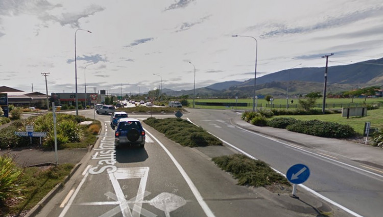
The previous intersection lacked quality cycling and walking provision despite the nearby proximity of schools and walking / cycling paths. This is obvious in the images below.

Before photograph, looking towards Saxton Fields from Salisbury Road.

Before photograph, looking from the roundabout towards Champion Road (S), the yet to be developed Countdown site and Salisbury Road (W).
An underpass was considered safe and kept cars flowing but was too expensive. A safer roundabout that also helped bikes could serve the multilane approaches and better fit with the land use and movement of people, and while it slowed cars a little it also met driver safety needs.
Extensive consultation included adjacent landowners, the local schools (7 in total), groups representing different aspects of transport (biking, AA, local businesses) and traffic modelling identified a reduction to a single lane on one of the approaches was feasible.
Two of the roundabout arms with walking and cycling desire lines were treated with raised dual crossings on single lanes approaches for safety, a minor side road was aided with a table because crossing movements were already easy, and the remaining arm was unchanged due to lack of pedestrian desire lines. Crossing positions were located as close to natural desire lines as possible, crossing locations were modelled (in a Paramics Model) to refine the location and enabled an informed evidence-based decision.


