Ngā FAQ o ngā rori utu – FAQs on tolling
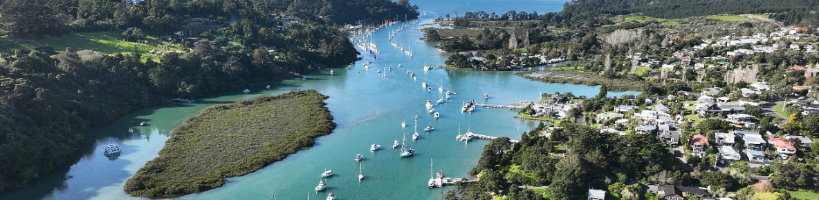
The locations of toll points on this map are indicative only and should not be interpreted as definitive locations.

Why will O Mahurangi – Penlink be tolled?
Tolling revenue will pay for the ongoing maintenance and operations costs. Tolling will result in better performance across the transport network, resulting in fewer carbon emissions compared to not tolling the road.
The Government is only funding the planning and construction of the project through the New Zealand Upgrade Programme (NZUP). This does not include the ongoing maintenance and operations cost.
O Mahurangi-Penlink will be a connecting road serving specific communities rather than part of the national network. It will be built over challenging terrain and includes a significant 540m long bridge crossing the Wēiti River. Consequently, the ongoing costs of maintaining the road and operating it, to optimise public transport and general traffic, are expected to be higher than the standard costs for a connector road of this type.
What are the benefits of tolling O Mahurangi – Penlink?
By 2027, a tolled O Mahurangi – Penlink will improve the road user experience on the two-lane road. It will reduce travel time by 22 – 26 minutes during morning and afternoon peak hours, when compared to a 'no build' scenario.
Tolling will also provide positive sustainable outcomes like lower carbon emissions and a safer road environment. Please see the toll modelling report for O Mahurangi – Penlink for more information on the publications page.
Publications page(external link)
What is variable tolling?
Variable tolling means different toll prices for off-peak and peak hours*. Variable tolling helps people make choices about the time they travel, and therefore the toll price they pay. People can still access free alternative routes if they do not want to pay the toll.
Variable tolling also allows better management of the transport network, reduces travel times during peak hours, and more consistent operation of transport networks.
*Proposed peak hours: 6am to 9am and 4pm to 7pm, Monday to Friday. Any time outside of those hours are proposed as off-peak hours (including Saturdays, Sundays and public holidays).
How much would a light vehicle be tolled when using O Mahurangi – Penlink?
The toll is $2.00 for off-peak hours and $3.00 for peak hours for light vehicles travelling the full 7km length. Lower toll prices are in place when for travelling along only part of O Mahurangi – Penlink.
What is a light vehicle?
A light vehicle is a car, motorcycle or light commercial vehicle (3.5 tonnes or less).
How much will a heavy vehicle be tolled when using O Mahurangi – Penlink?
When travelling the full 7km route, the heavy vehicle toll price is $6.00 for peak hours and $4.00 for off-peak hours. Lower tolls are in place when travelling along only part of O Mahurangi – Penlink.
O Mahurangi – Penlink toll pricing [PDF, 112 KB]
Tolling consultation
When did Waka Kotahi consult on the tolling proposal?
Waka Kotahi consulted on a proposed tolling scheme for O Mahurangi – Penlink between 17 January and 13 February 2022.
What were the key feedback themes from the consultation?
Many suggestions were made by respondents, including:
- lower and/or flat toll prices
- fewer tolling points
- peak and off-peak toll price changes
- concession rates for residents and frequent users of the highway.
How many people supported tolling?
There was an overwhelming response to the tolling consultation with 3,337 responses from the community and stakeholders.
Thirty-seven percent (1,235 people) supported tolling O Mahurangi – Penlink. This was made up of 20.5 percent supporting is as proposed and 16.5 percent supporting tolling but with changes to the proposal.
Sixty percent (2,002) of respondents did not support tolling.
Public feedback report [PDF, 1.2 MB]
Public consultation submissions [PDF, 2.8 MB]
How has public feedback been taken on board as part of decision making?
Feedback was analysed and used to improve the proposed tolling scheme. All submissions were included in the comprehensive tolling proposal that was provided to the Government for a decision,
Were amendments to the proposal made after consultation?
Following consultation, the tolling proposal was amended to address community concerns:
- the toll price was reduced by 25 percent for end-to-end peak trips which help to address the concern that the rates were too high.
- the number of toll points was reduced from three to two. A toll point was originally considered at the Stillwater interchange, but was not pursued to help improve efficiency of the tolling scheme.
All submissions, including the consultation report, was provided to the Minister of Transport for consideration alongside the tolling scheme proposal.
Penlink tolling scheme proposal [PDF, 1.9 MB]
Toll points
How do the toll points work?
Toll points are the gantry structures with number-plate recognition cameras to allocate the appropriate toll price.
Where will the toll points be located?
Two toll points will be located at:
- the SH1 Interchange connecting to O Mahurangi – Penlink
- East of the Wēiti Bridge.
Are there free alternative routes for people who want to avoid the toll?
Yes, the Land Transport Management Act (2003) requires that a feasible and free alternative route is available.
People in the Whangaparāoa Peninsula can still use Whangaparāoa Road to access SH1 via the Silverdale Interchange and Stillwater residents can access Duck Creek Road as an alternative route. Travel between Stillwater and East Coast Road on O Mahurangi – Penlink, will not incur a toll due to the location of the toll points.
Will more toll points be added?
Any new toll points added to the tolling scheme would be subject to approval from the Minister of Transport.
Proposed prices
Will the toll prices be different depending on where you travel on O Mahurangi – Penlink?
Different toll prices will apply depending on how far you travel. For example, if you travel in a light vehicle from SH1 all the way to Whangaparāoa Road, you will pay $3.00 each way during peak hours. But if you travel from East Coast Road to Whangaparāoa Road in a light vehicle the cost will be $2.00 each way during peak hours, and $1 each way during off-peak hours.
O Mahurangi – Penlink toll pricing [PDF, 112 KB]
Where is the “Future urban zone connection” which is shown in the toll pricing tables?
The “Future Urban Zone connection” would be approximately 1km east of East Coast Road. This is to help facilitate traffic from future developments in the area.
Why is there no toll for travel between East Coast Road and Stillwater?
Following consultation the number of toll points was reduced from three to two
Travel between East Coast Road and Wēiti Precinct on Ara Wēiti Road runs almost exactly along the O Mahurangi – Penlink route. It will no longer exist once O Mahurangi – Penlink is complete.
For people travelling between Stillwater and East Coast Road, there will remain the option to continue to use Duck Creek Road.
Travel between these locations and East Coast Road (and vice-versa) will not pass a toll point. This will be until another route is available to those road users.
Why are the tolling prices higher for heavy vehicles?
The amount road users pay depends on the type of vehicle they are driving. Heavy vehicles create more wear and tear on the road than light vehicles. The heavy vehicle toll prices for using O Mahurangi – Penlink will be $6.00 for peak hours and $4.00 for off-peak hours when travelling the full 7km each way.
What does the toll tariff pay for?
A toll fee pays part of three separate components:
Goods and Service Tax (GST)
Toll revenue will be for road maintenance and operations:
- which includes regular and periodic road maintenance, bridge inspections and road resurfacing as well as periodic bridge maintenance and repairs.
- toll operating revenue which is the amount retained by Waka Kotahi to operate the toll business. This pays for the personnel costs, transaction charges (i.e., bank charges), depreciation, information technology support, maintenance and upgrades and other operating costs.
Will the toll prices change over time?
Waka Kotahi assesses and reviews the toll rates regularly and may make changes over time. Toll prices are based on the revenue collected against the expected ongoing expenses for maintaining and operating the road.
How long will tolling continue?
O Mahurangi – Penlink will be a permanent toll road.
Is the shared walking and cycling path tolled?
No as it provides travel choices along the route.
How is tolling different from the Regional Fuel Tax?
Tolling for O Mahurangi – Penlink specifically covers the maintenance and operations costs of the new road. The Regional Fuel Tax in Auckland helps Auckland Council progress and fund specific transport projects as per the Auckland Transport Alignment Project.
Auckland Transport Alignment Project(external link)
As part of Auckland Council’s Long Term Plan, in 2021 it adjusted the RFT scheme to no longer include O Mahurangi – Penlink. The money was reallocated to other investments.
View the updated Order in Council(external link)
O Mahurangi – Penlink has not received any funding from the RFT since 2020, when Waka Kotahi took over the project as part of NZ Upgrade Programme which is Crown funded.
How will I pay my toll?
You can set up an account with Waka Kotahi and the toll is automatically deducted from your account. People can also pay on our website, call the freephone number or visit one of the cash payment points.
Pre-pay toll methods will not be available due to the variable toll prices depending on when and where you travel from.
What's the best way to pay my toll?
Has Waka Kotahi considered the nearby planned developments in the toll modelling?
Yes. The toll modelling considered growth in the Wēiti Precinct, Milldale, Dairy Flat and other future developments.
Do you have any further questions?
If you have any other questions, contact us at OMahurangi@nzta.govt.nz or 0800 PENLINK (0800 7365 465).